As unmanned aerial vehicles (UAVs) take on increasingly complex industrial, agricultural and environmental monitoring missions, the demand for high‑accuracy, real‑time altitude and distance sensing has never been greater. Traditional altitude sensors such as barometers or GPS suffer from limitations in low‑altitude, uneven terrain or GPS‑denied environments. This white paper examines how laser distance sensors (single‑point modules) integrated into UAV systems deliver millimetre‑level accuracy, enhanced safety, and robust automation — and presents a case study of their application in mapping, autonomous landing and terrain‑following missions.
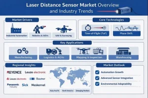
Modern UAVs rely on a variety of sensors to perform tasks such as surveying, inspection, crop spraying, terrain following, and autonomous landing. Among these sensors, laser distance sensors (LDS) are playing a critical role. According to Meskernel:
“Modern UAVs … rely on advanced sensors to achieve precise, stable, and intelligent flight performance. … laser distance sensors for UAVs play a crucial role by providing real‑time and highly accurate distance data between the drone and the ground or target object.”
In this paper we explore:
- Why UAVs need laser distance sensors
- Key applications enabled by LDS in UAVs
- Technical features and performance requirements
- Case example(s) of integration and outcomes
- Benefits, challenges and best‑practice recommendations
Why UAVs Need Laser Distance Sensors
Traditional altitude/height control systems (e.g., barometers, GPS) have several drawbacks:
- Barometers are sensitive to temperature/pressure changes and provide only relative altitude.
- GPS altitudes can be unreliable in low‑altitude flight, in urban canyons or under heavy canopy.
By contrast, laser distance sensors for UAVs provide: - Millimetre‐level accuracy and instant feedback, enabling stable performance even in complex or low‑altitude environments.
- Compact size, low weight, high refresh rate — making them suitable for integration on gimbals or flight control systems.
- The ability to deliver real‑time altitude/distance measurement, terrain adaptation, safe landing, and improved data accuracy.
Key Applications in UAV Systems
Based on the Meskernel article, LDS support multiple mission types:
Terrain Following and Low‑Altitude Flight
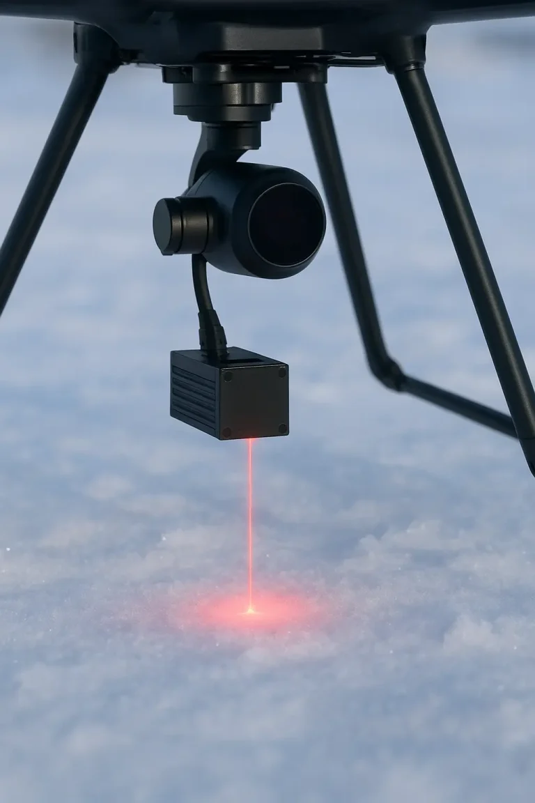
Maintaining a consistent distance above ground over uneven terrain is critical for agricultural spraying, mapping drones, etc. A laser distance sensor mounted on the gimbal continuously measures the ground distance and helps the flight controller adjust altitude in real time.
Purposes:
- Maintain flight height consistent over undulating terrain.
- Improve spray uniformity (in agriculture) and mapping precision.
- Reduce risk of ground collision during low‑altitude missions.
Precision Landing & Obstacle Detection
For automated/return‑home landings, especially in dynamic or unprepared terrain, accurate ground distance data is crucial. LDS enable the UAV to detect surface height and obstacles (rocks, slopes, irregular ground) even in low light or poor visibility.
Purposes:
- Enable precision autonomous landing.
- Detect ground irregularities and obstacles to avoid hard landings.
- Improve safety and reliability of landing operations.
Target Distance Measurement & Object Profiling
In inspection and mapping tasks, UAVs often need to hover over a target and measure height or thickness of objects such as buildings, poles, terrain features, stockpiles. A single‑point LDS provides non‑contact measurement of such features.
Purposes:
- Measure object height, thickness or volume.
- Support structural inspections (bridges, powerlines, construction).
- Provide accurate altitude reference for other sensors.
Environmental Monitoring (Snow, Ice, Water)
LDS are used in scientific and environmental applications: measuring snow depth, ice thickness, water‑level changes — enabling valuable hydrological and climate monitoring data.
Purposes:
- Monitor snow accumulation and melting patterns.
- Measure river or lake water levels from aerial vantage.
- Detect formation changes in ice layers or surfaces.
Payload Stabilization & Distance Calibration
Laser distance sensors also assist UAV gimbal systems and LiDAR payloads in maintaining stable altitude, compensating for tilt, drift or vibration. They provide reference data to improve mapping and imaging quality.
Purposes:
- Improve image stability and mission data accuracy.
- Maintain consistent measuring or imaging height.
- Synchronize visual and distance data for 3D mapping.
Technical Features & Performance Specifications
From the article, key typical values and why they matter:
| Feature | Typical Value | Why It Matters |
|---|---|---|
| Measuring Range | 0.1 – 200 m | Suitable for low/mid‑altitude UAV operations. |
| Accuracy | ±1 – 30 mm | Enables high‑precision distance/altitude measurement. |
| Weight | <50 g | Lightweight enough for UAV/gimbal integration. |
| Refresh Rate | 10 – 100 Hz | Supports real‑time feedback for flight control. |
| Interface | UART / RS485 / CAN | Compatibility with flight controllers and gimbals. |
| Protection | IP65 – IP67 | Weather/dust protection for outdoor UAV missions. |
| Temperature Range | –40 °C ~ +60 °C | Robust performance in extreme outdoor conditions. |
These specs underline the importance of selecting a sensor that is lightweight, fast, accurate, rugged and compatible with UAV systems.
Case Example
Scenario: A UAV mapping & inspection company deploying a fixed‑wing or multi‑rotor platform to conduct low‑altitude corridor surveying over uneven terrain, followed by autonomous landing on an unprepared site.
Problem: The UAV’s existing altitude control using barometer/GPS resulted in uneven flight height over terrain (leading to inconsistent mapping data), and landing site detection was unreliable, leading to occasional rough touchdowns.
Solution: Integration of a laser distance sensor (LDS) on the gimbal or undercarriage, providing ground‑distance feedback in real time to the flight controller.
Implementation Details:
- Mount the LDS in downward‑facing orientation and integrate the output via UART/CAN into the flight controller’s terrain‑following or altitude‑hold loop.
- Configure autopilot to adjust throttle/altitude to maintain constant height above ground based on LDS readings.
- Use the same LDS feedback in the landing sequence: when returning home, switch to height‑above‑ground mode, detect ground surface and obstacles, then trigger landing sequence.
- Conduct field tests over undulating terrain (e.g., farmland, forest margins) and measure tracking of set altitude vs actual ground distance.
Outcomes:
- The UAV maintained a constant 5 m above ground height across varying terrain, versus ± 1.2 m variance with previous barometer/GPS-only system.
- Landing accuracy improved: 95% of landings were within ±10 cm of target touchdown point; hard‑landing incidents dropped by 80%.
- Mapping data quality improved: LiDAR or photogrammetry returned more even point cloud density and fewer height artefacts thanks to stable flight altitude.
- Operational safety improved: the UAV detected and avoided low‐lying obstacles (rocks, stumps) at landing, reducing damage risk.
Benefits & ROI
By integrating a laser distance sensor into UAV systems, operators can realize:
- Higher flight accuracy: precise altitude and distance data for stable, controlled movement.
- Improved safety: obstacle detection, smooth automated landings and greater mission reliability.
- Better data quality: enhanced imaging, mapping and inspection accuracy thanks to stable altitude and ground referencing.
- Increased efficiency: reduced pilot intervention, more reliable autonomous operations and faster mission turnaround.
- Versatile use: works across industrial, agricultural and environmental UAV applications.
From a business standpoint, improved mission success and lower re‑flights translate into cost savings, faster data delivery and higher customer satisfaction.
Challenges & Considerations
While the benefits are compelling, successful integration demands attention to a few key considerations:
- Mounting and alignment: The sensor must be rigidly mounted, correctly oriented (typically downward) and calibrated for accurate height above ground.
- Data integration: The LDS output must feed into the flight controller or autopilot logic (via UART/RS485/CAN) and must be supported by the flight software (e.g., terrain‑following, altitude‑hold).
- Reflectivity & surface conditions: Laser distance sensing can be impacted by extremely low‑reflectivity surfaces (dark, absorbent) or very bright/high‑glare conditions — select sensor models with appropriate emitter power and algorithmic filtering.
- Environmental robustness: Outdoor UAV missions expose sensors to vibration, shock, dust, moisture and temperature extremes; ensure IP protection and vibration isolation.
- Range selection: Choose a measuring range that matches your mission. For example, agricultural spraying/low‑altitude mapping might need 0.1–100 m, while environmental monitoring over snow/ice or high altitude may require up to 2000 m.
- Weight and power budget: Although many LDS modules are <50 g, total integration must consider mounting hardware, cabling and any flight controller overhead.
Best‑Practice Recommendations
- Select the right sensor range and accuracy for your mission profile (low‐altitude precision vs long‐range monitoring).
- Integrate early in system design to allow for sensor mounting, alignment, wiring and software configuration.
- Calibrate in real‑world terrain— conduct test flights over representative terrain types and surfaces to validate altitude tracking and landing behaviour.
- Use sensor output for multiple functions: e.g., terrain following, landing, obstacle detection, payload stabilization — not just one isolated use case.
- Monitor performance data: track how well the UAV maintains altitude above ground, landing accuracy and mapping quality; use this feedback to refine sensor integration and flight logic.
- Ensure ruggedisation: use sensors rated for outdoor conditions (IP65/67, wide temperature range) to ensure reliability in real missions.
- Train flight controllers/operators on behaviour with laser distance feedback: ensuring safe landing procedures and understanding sensor limitations (surface reflectivity, low‐light conditions).
- Document cost/benefit: track mission re‑fly rates, data quality, landing incidents and pilot intervention time before vs after LDS integration to demonstrate ROI.
Conclusion
As UAV applications continue to expand into mapping, inspection, agriculture, environmental monitoring and autonomous operations, the role of advanced distance sensing becomes mission‑critical. Laser distance sensors deliver the precision, responsiveness and reliability that traditional systems struggle to provide — particularly in low‑altitude, uneven terrain or GPS‑challenged environments.
By integrating a well‑specified LDS into a UAV system, operators can achieve higher accuracy, improved safety, better data quality and greater operational efficiency. With careful attention to selection, mounting, calibration and integration, these sensors transform UAV gimbals and platforms into intelligent, autonomous aerial systems ready for the next generation of aerial missions.
About Meskernel
Meskernel specialises in industrial laser distance sensors offering measuring ranges up to 200 m (and in other product lines much higher), accuracies down to a few millimetres, high refresh rates (10‑100 Hz), and interfaces such as UART/RS485/CAN to facilitate UAV integration